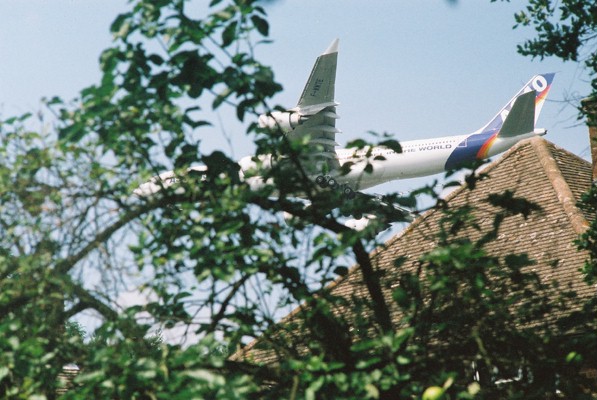
 Safe? Residents with long memories can recall numerous crashes over
more than half a century, averaging out at approximately one crash
every six years.
Safe? Residents with long memories can recall numerous crashes over
more than half a century, averaging out at approximately one crash
every six years.
Farnborough is to become the Teterboro of London. -- Roger McMullin, CEO TAG Aviation Group
Fill your small car with petrol to drive to your granny's and most of the bill for it goes in fuel duties. Governments defend the tax by saying we should use cars less to protect the environment. Fill a vast jumbo with fuel to fly a bunch of businessmen across the Atlantic and the airline pays not a penny in tax. It takes a mighty large fleet of family saloons to do the damage of one jumbo. -- John Humphries, presenter Radio 4 Today programme
So long as use of London's airports costs the traveller next to nothing, demand curves doubling every 20 years (or indeed every 10) can be drawn ad infinitum to bamboozle ministers and the public into supposing quite falsely that extra capacity is needed. -- Peter Jay, former economics editor of the FT and BBC and UK ambassador to Washington
TAG Aviation have made application to discharge conditions 16 and 17 of their outline planning consent for a business airport at Farnborough - 1:10,000 and 1:100,000 risk contours.
TAG Planning Application to Rushmoor Borough Council Reference Number 99/00658/OUT (Farnborough Aerodrome).
TAG application to discharge condition 16 (1:10,000 risk contour) planning ref 02/00662/MISCON.
TAG application to discharge condition 17 (1:100,000 risk contour) planning ref 02/00663/MISCON.
The introduction on the Rushmoor web site is misleading and incorrect. We are dealing with the death of an individual not an incident and this should be emphasised.
A 1:100,000 per annum individual risk means for example, that at the point of exposure 24 hours a day, 365 days a year there would be a probability of an incident occuring once every 100,000 years.
The definition of the risk is incorrect. It should be defined as follows (and the web site corrected):
A 1:100,000 per annum individual risk means that at the point of exposure 24 hours a day, 365 days a year there would be for any one individual a probability of 1:100,000 that they would be killed in any one year.
The contour is drawn by linking together these points. The risk of death increases for individuals within the contour and decreases for those outside the contour.
To put this probability in context, there is a far greater chance of being killed in Farnborough by an aircraft than there is of winning the Lottery, and yet people are willing to gamble a pound in the mistaken belief they have a reasonable chance of winning the Lottery.
Only risk of death has been considered. That of serious injury should also be considered, at least an order of magnitude greater.
The risk contours only consider the death of any one individual. They take no account of the population within the contours, or the risk to any particular concentration of people. For example, a house, a block of houses, a kindergarten, an office or the college, all of which lie within the 1:100,000 risk contour. A crash on the college would result in several hundred dead and many more seriously injured.
It is important to emphasise that the definition of risk for the purpose of drawing the risk contours is the probability of death of any one individual, not the death of anyone (no account taken of population density), nor are we defining the probability of a crash (as many local residents have been led to believe by a deliberately misleading letter sent out by Rushmoor planning officials). The probability of a crash is many orders of magnitude greater than the probability of the death of any one individual.
If a crash occurs within the risk contours, and the risk contours enclose a populated area, then people will be killed, on the other hand although a crash may occur, any one individual may not be killed. Thus risk contours can be extremely misleading if no account is taken of the population within the risk contours.
At Farnborough, the likelihood of a crash is roughly 1 crash every 36 years. The Secretary of State has agreed that there is a 25% chance of a crash over Farnborough in the next ten years. When a crash occurs the number of deaths will range from half a dozen dead if a couple of houses are hit, through to a dozen or more young children killed if the kindergarten is hit, to several hundred dead (and many more seriously injured) if the college is hit. Of the many scenarios possible, a crash on the kindergarten or college is most probable.
1 crash every 36 years may be overly optimistic. Farnborough Airport is to be an exclusively business airport, as the authors of the TAG report agree, business aviation has a much higher crash rate.
Apart from the house-bound, those with the maximum exposure are staff and students at the college, for many as long as 12 hours in any one day. They are also in the position of maximum risk. They have not been notified of the risk (nor have the parents of these students, many of whom are legal minors). Neither have those who work within the contours, eg the tour operator in the Old Library, BMW garage, etc, neither have the parents of the young children at the kindergarten.
In light of the serious nature of the matter under consideration, the failure to notify borders on criminal negligence, for which councillors bear ultimate responsibility.
The council has a moral and legal duty to consider the safety of those on the ground. Should individual councillors choose to ignore the expert advice given and subject the local community to an unacceptable risk they will lay themselves open to future litigation.
The council has to agree the risk contours. This does not just mean their physical location on the ground, although clearly the accuracy of the contours is of concern. The primary concern of the council is the extent of the contours and the number of people and their property to be be affected by the contours and whether it is acceptable to the local community to be subjected to such an intolerable risk.
At Farnborough a greater number of people will be bounded by the risk contours than any other UK airport. The risk is therefore unacceptable. Even more so when no benefits accrue to the local community from the airport, whereas on the other hand the local community suffers all the disbenefits, eg risk of a crash, noise, deteriorating air quality, traffic congestion, degraded local environment, flooding and contamination of Cove Brook, falling house prices, etc.
Risk is cumulative. MoD, SBAC and diplomatic immunity flights all impose risk on the local community. When considering the risk imposed by TAG, the council must take into account the risk imposed by all movements at Farnborough, not that of TAG alone.
In Parkins v Rushmoor, the council are under an obligation to seek 'independent advice' before they can proceed with this application. To date this has not been done, even though the council has had every opportunity to do so since the settlement at the beginning of the year. The council has even lacked the courtesy to notify the litigant that TAG has submitted an application and this had to be discovered from reading the Surrey-Hants Star (Thursday 12 September 2002).
For the purpose of discharge of conditions 16 and 17, the council is only obliged to consider the number of movements and mix granted to TAG in their outline planning consent, ie 28,000.
For a public safety zone (PSZ), the council has to draw the PSZ (defined by the 1:100,000 risk contour) for the number of movements in 2015. The council is under government direction to establish a PSZ for Farnborough Airport.
TAG have already stated (on several occasions) that they are seeking massive expansion. The most recent was at Farnborough International 2002, where Roger McMullin (Geneva based TAG CEO) stated Farnborough was to become 'the Teterboro of London'. Teterboro, operating out of New Jersey and serving New York, is a 24-hour round-the-clock operation, the world's busiest business airport. At Teterboro, local residents have managed to ban the Boeing Business Jet as not safe, cf Farnborough, where councillors overturned the Local Plan, only just agreed, to bump up the weight limit (50 tonnes to 80 tonnes) to allow the Boeing Business Jet to use Farnborough.
US FAA has recently issued a warning that Boeing 737s have a faulty flight control system. A further warning has been issued of faulty fuel pumps that could cause an explosion.
Within the PSZ people are not permitted to work, live or congregate, ie no houses, no schools, no offices, no car parks (other than long stay), not even playing fields. At Farnborough, the non-permitted development already exists, ie if people did not live beneath the flight path and if this was open land (as is the norm at most airports) the housing etc that currently exits beneath the flight path could not be built. The PSZ is a sanitized zone in which there should be no people as it is NOT safe, in the long term, for reasons of safety, the Secretary of State wishes to see people removed from this blighted zone.
There has been the usual dismal failure (the norm for Rushmoor) to notify those affected. Head of Planning Keith Holland gave an assurance (phone conversation Friday 13 September 2002) that 'widespread consultation' would take place. On close examination this 'widespread consultation' was the above mentioned notice in the Star. This is notification, not consultation. As an absolute minimum, notification should include all those who have commented on the relevant part of the Local Plan and the TAG planning application, and all those who are affected by the risk contours, including those outside the borough and the Basingstoke Canal Society. Notice should also be placed on the Canal notice board at Ash Lock and a notice displayed in the Canal Centre at Mytchett. Anything less will be seen as maladministration by the council.
All received comments should be placed before councillors, not a distorted misrepresentation by planning officials acting on behalf of the developer. Anything less will be seen as maladministration by the council.
Failure to place received comments before councillors will be treated as a breach of the Human Rights Act.
The report submitted by TAG, the Rushmoor web site does not make this clear, should contain details of the authors (lacking on web site) and their authority and expertise in this area.
The authors of the TAG report, AEA Technology, are mentioned on Rushmoor internal documents, but no further information eg contact details, expertise, etc.
The report submitted by TAG is a shoddy piece of work and should be binned. A report submitted by TAG or on behalf of TAG is not an independent report.
The authors of the report fail to give the crash statistics used. The methodology and data should be made transparent to enable others to replicate their work. More than one model should be used to determine the risk contours (and the downside of each model noted).
The authors choose the NATS model in preference over other models, but give no valid reasons why. Could it be the other models show a worse situation for Farnborough, ie more people placed at risk?
The tables showing aircraft mix are clearly faked. Statistically highly improbable for average weights to always be midway in each weight range. Tables should show mix at current movements over the last few years, the projection to 28,000 movements and the assumptions used for the projection. Should also show sensitivity of risk to variation in aircraft mix. Tables show twin rotor at 3% of mix, but weight not applicable! As noted above, crash rates used are not stated. Tables should also show crash consequence area for each weight range.
Other than showing what is the expected weight mix of aircraft, which may be of passing interest, of what merit is the table? Of importance is the crash rate for each aircraft type using Farnborough, then using the weight and size the crash consequence area can be calculated and contribution to overall risk determined. There is an implicit assumption in the weight mix table that at each weight range the crash rate is the same. Whether or not valid (highly unlikely) we do not know as the authors fail to provided crash statistics.
The authors of the report rubbish the NATS model (it does have flaws) but then use it!
The authors of the report repeatedly claim the NATS model overestimates the risk, but supply not a shred of evidence to support what they are saying.
The NATS model underestimates the risk for several reasons. It assumes a flat plane (Farnborough Airport is in a hollow), the glide slope is steeper than a usual airport approach, the crash rate for a class of aircraft is used (not the subset for business use which has a much higher crash rate), it does not include helicopter movements, etc.
The authors of the report correctly state that business aviation crash rates should be used, and quite correctly state these are much higher. This one factor alone would give a much higher risk to the local community.
The authors of the report state the operation at Farnborough would be much safer, thus would have a much lower crash rate. There is no basis in fact for this statement as the TAG operation has no history from which to make such a comment and statistically is ridiculous. It implies that all other airports are less safe than Farnborough, which again is quite ridiculous.
Did the authors of the report actually visit Farnborough, as clearly they have never witnessed the cavalier attitude that prevails?
Aircraft do NOT follow the flight path, they are all over the place and at various heights (too often too low giving a very low margin of error). The ILS appears to malfunction, or else no one uses it. During the recent airshow (Farnborough International 2002) the ILS was turned off! The ILS is extremely sensitive to reflections causing beam distortion. Has the ILS been calibrated for a 2 degree approach when it is most prone to reflections from the ground and the local community is most at risk? Aircraft use Farnborough during very poor visibility. There has been a number of aborted landings on the approach to Farnborough. Had the pilots not aborted they would have crashed somewhere between Church Circle and the end of the runway.
TAG have admitted at public meetings they have no control over the flight paths used by pilots at Farnborough, and have admitted they have no means of monitoring.
Safe? Residents with long memories can recall numerous crashes over
more than half a century, averaging out at approximately one crash
every six years.
Going even further back Sam Cody was killed when his plane crashed at Farnborough. The superstitious could be forgiven for believing the site was jinxed.
During TAG's brief 'unofficial' tenure, there has been at least one crash. There has also been a crash in France of a plane that took off from Farnborough, the indications point to the cause as faulty maintenance at Farnborough. An aircraft that took off from Farnborough was forced to make an emergency landing at Farnborough when the cockpit filled with fumes.
For such a brief history, and small number of movements to date, TAG's operation has had a remarkable number of 'incidents' which leads one to say with some justification that their operation is anything but safe.
An implicit assumption (it is not declared) is that at Farnborough planes are following the centre line of the runway. They do NOT. Thus the risk contours drawn bear no resemblance to the situation on the ground.
This is reinforced by data submitted by TAG to support their noise monitoring and tracking under the Section 106 agreement between TAG and Rushmoor (7 August 2002, appendix 3) which shows aircraft on takeoff over Farnborough veering off south over south Farnborough and North Camp. The other routes shown with aircraft keeping to the centre line of the runway several miles away from the end of the runway, is, as anyone who has observed from the ground knows, pure fantasy.
Published crash rates are a subset of known crashes, they record only where someone is killed or there is a write-off of the plane. Whilst this may be applicable in most circumstances, eg where the crash zone is open space, it is not applicable to Farnborough where the crash zone overlays a built up residential area. Crashes at other locations where no one is killed because no one is on the ground, thus not recorded in the published crash rates, are far more likely to result in death at Farnborough, due to the nature of the locality in the immediate vicinity of the airport.
The risk contours for Farnborough should be calculated using all known crashes for this type of operation, not an inappropriate, restricted subset.
The crash consequence area only takes account of the physical impact on the ground. It takes NO account of the fuel on board. A fully-fuelled Boeing Business Jet (Boeing 737) is carrying as much fuel on board as a Boeing 747 (ie 35 tonnes). Imagine the consequences of such a crash on the college.
What are the aircraft carrying? We don't know. In the absence of Customs no one else knows either. It is ten years since the crash of an Israeli plane in Holland. On board was radioactive material and the precursors for nerve agents. Many more have died and been made seriously ill than died in the crash. High fatalities were in part due to the plane crashing in a residential area.
A high proportion of the aircraft using Farnborough will be of Middle East origin. A figure that should concern everyone in the continuing War on Terrorism.
In excess of 80% of crashes occur on takeoff and landing at the end of the runway, ie where people in Farnborough live, work and study. The Secretary of State has admitted there is a 25% risk of a crash over Farnborough in the next ten years.
The 1:10,000 risk contour extends beyond the airfield boundary at the western end, ie over the canal towpath, over the canal and over the main Aldershot to Fleet road. This part of the canal is a favourite spot for fishing, ie people congregate. Only those who benefit from a hazardous operation may incur a 1:10,000 risk, ie they have a choice, third parties should not be subjected to the risk, the 1:10,000 risk contour should NOT extend beyond the airfield boundary.
The Secretary of State regards the maximum tolerable level of individual third party risk as 1:10,000.
The most important statement made by the authors of the TAG report: 'the risks estimated using the model should not be viewed as representing the real risk at any given airport'. An amazing admission and on this one statement alone the report from TAG has to be rejected.
As the appropriate authority the council has the statutory duty to safeguard the Human Rights of those affected by this application, in particular the right to life and the right to protection of property. Failure to safeguard these rights would be a breach of the Human Rights Act. The Human Rights Act takes precedence over existing legislation, including planning.
This is the first time the council has had the opportunity to consider the risk imposed by the TAG operation and the implications it has for the safety of those on the ground.
On the basis of the unacceptable risk, the council should REJECT the TAG application to discharge conditions 16 and 17.
Planning documents
This document
Websites
References
Keith Parkins, Objections to Inspector's Report on Rushmoor Local Plan
(Farnborough Airfield), August 2000
Keith Parkins, Objections to TAG Planning Application (Farnborough Airfield),
September 2000
Keith Parkins, Farnborough Airfield Judicial Review, UK Indymedia,
4 February 2002
Control of Development in Airport Public Safety Zones, DfT Circular 1/2002,
Department for Transport, 10 July 2002
Mike Vines, Farnborough Future: 'London's Teterboro', Aviation Week's Show News,
24 July 2002 {Farnborough International 2002}
Martin Delgado, 3,000 aircraft at risk from fuel-pump fault, Evening Standard,
24 September 2002
Nupul Agrawal and John Napier, Fight or flight?, The Ecologist, October 2002
Nicholas Faith, Black Box: Why Air Safety is No Accident,
Boxtree/Channel 4, 1996
Health Council of the Netherlands, Risk is more than just a number,
Health Council of the Netherlands, 1996
Ed Vulliamy, Catalogue of crashes batters Boeing name, The Observer, 7 November 1999
Graham Wood, letter to Richard Short re malfunctioning ILS and poor flight
tracking, 9 September 2002
Farnborough Aerodrome - Risk Contours - Response To Planning Condition 16
Farnborough Aerodrome - Risk Contours - Response To Planning Condition 17